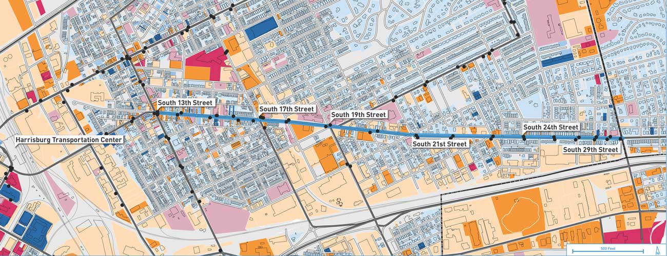
We are excited to welcome a record-breaking Rail~Volution crowd to Pittsburgh this month! As such, we will be using the conference’s hashtag to invite our friends from out of town to take local transit to food and drink spots all around the city.
Lidar is a technique using light radar as to locate and map points in 3D. Lidar is not a new tool, but it’s application in urban design has been quickly expanding. In conjunction with Lidar, the use of Photogrammetry has also emerged as an accessible means of generating high-resolution models for recoding and analyzing our environment.
Improving, connecting, and activating Mount Lebanon’s transit district The Uptown Business District in Mount Lebanon, Pennsylvania is enjoying a renaissance.... View Article
While traditional development focuses on developing the built environment, ecodistrict planning focuses on developing both the hardware AND software of a community.
Building Codes for a Better Built Environment There has been activity in the Pennsylvania legislature this Fall session. First, Governor... View Article
Art can knit together the lived experience of neighborhood identity with long term and sometimes abstract principles of community development. The Pittsburgh community of Larimer has been cultivating a local culture of sustainability through ecodistrict planning and has used art and creative placemaking to build capacity around neighborhood stormwater issues, urban agriculture and economic development.
Rail~Volution returns to Denver in 2017 and in the short time since 2000, Denver has been transformed from a car-required public transit desert into a car-optional multimodal public transit leader.