Data, Urban Strategies, & Visualization
Strategic Data Use to Stabilize Neighborhoods was a conference I attended December 6-7 in Baltimore. Around 200 were in attendance, all of us connecting with data differently in our work: community leaders, municipal staff from cities across the US, researchers, urban planners, financial and real estate professionals and a healthy variety of folks from other backgrounds. Considering economic trends and the vast technological advances of the past 5-10 years, a significant range of topics within the realm of data and neighborhood stabilization were available for the conference organizers to focus on.
The event featured stories from planners and city workers on their use of data to track vacancy, foreclosures, and property-to-regional-level statistics in Cleveland, Detroit, Philadelphia, Pittsburgh, Baltimore, and a few other cities. It’s fascinating that such robust data systems in recent years have been developed at local and regional levels, even as funding for such projects is quite limited. There has been little inter-regional coordination among organizations and governments, which made this conference an important networking and sharing opportunity for many attendees. The highlights for me were a workshop called Visual Story-telling with Data led by design professionals to demonstrate the value of data visualization, and the fact that a number of presenters talked about sustainability at a conference where this was not a planned focus.
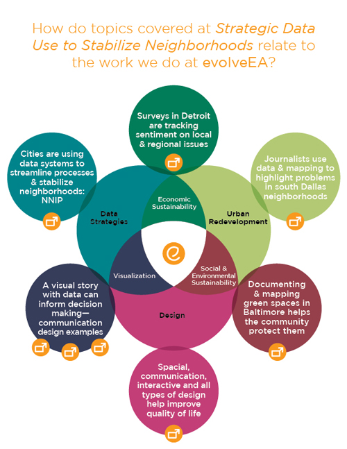
The graphic below illustrates topics covered at the conference and how they relate to our work at evolveEA. Specific examples are linked to the outer ring of the diagram—just click the buttons.


